


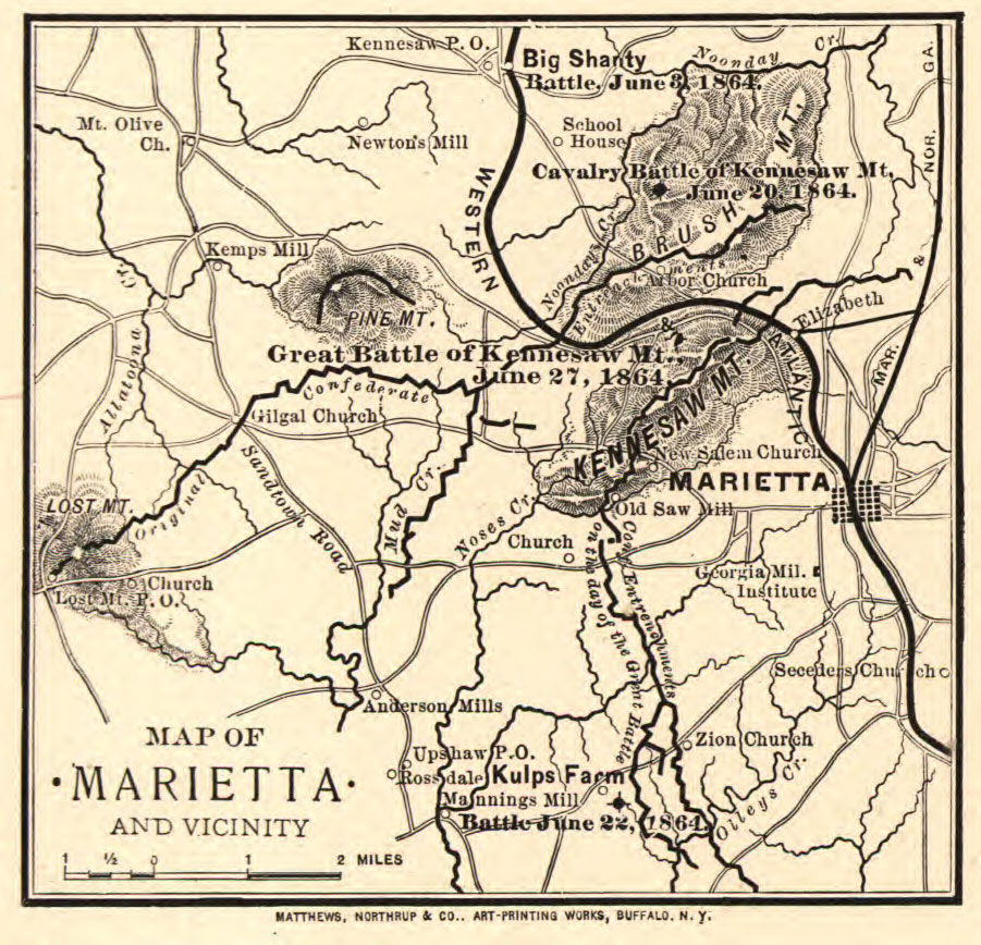
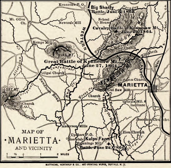
This Civil War era map was created in 1864. Click the image to see a larger version, or scroll down to see what the same area looks like today.
Map of Marietta and vicinity. [June 1864]
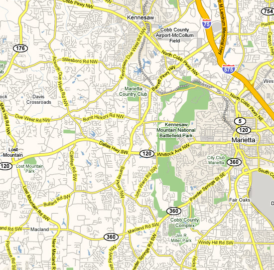
A comparison of then and now:
CREATED/PUBLISHED
Buffalo, N.Y., Matthews, Northrup & Co., Art-Printing Works, [1864]
NOTES
Scale ca. 1:185,000.
Reference: LC Civil War Maps (2nd ed.), 196.5
Indicates location and date of battles, Confederate entrenchments, roads, towns, drainage, and relief by hachures.
Description derived from published bibliography.
SUBJECTS
Marietta (Ga.)–History–Civil War, 1861-1865–Maps.
United States–Georgia–Marietta.
MEDIUM
1 map, 11 x 9 cm.
CALL NUMBER
G3924.M4S5 1864 .W4 CW 196.5
REPOSITORY
Library of Congress Geography and Map Division Washington, D.C. 20540-4650
DIGITAL ID
g3924m cw0196500
https://www.loc.gov/resource/g3924m.cw0196500/