

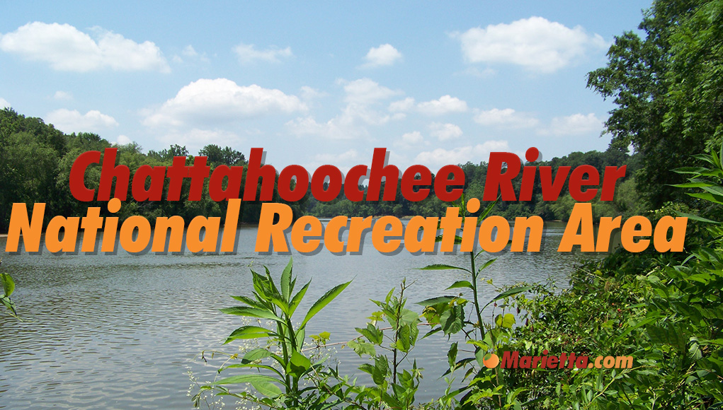
The Chattahoochee River National Recreation Area is part of the National Park Service and is visited by more than three million visitors a year. The area was established in 1978 to preserve and protect the scenic, natural, and recreational resources of the Chattahoochee River corridor. The area spans a 48 mile stretch between Buford Dam on Lake Lanier to the north and northwest Atlanta to the south that includes over 6,000 acres of land. Along the way, numerous parks and historic sites afford a wide range of outdoor activities, including fishing, boating, hiking, and wildlife viewing.

An Ancient River In A Modern City
The Brevard Fault Zone, a 320-mile-long geographical feature that separates the Appalachian Mountains and the Piedmont Plateau, is the location of the river and the park’s 15 units. Due to the river being constrained by the Brevard Fault, the river channel is among the oldest, most established, and steady river channels in the United States.
The park provides a living laboratory of the natural and cultural history of the region, with evidence of human habitation dating back over 10,000 years. The area was an important transportation route for Native Americans, who used the river to trade goods and move from one region to another.
Later, during the 19th and early 20th centuries, the river was used to power mills and generate electricity. The remnants of these historic mills and other structures can still be seen in the park today, providing a glimpse into the region’s industrial past.

The park is divided into several units, including the Vickery Creek Unit, the Johnson Ferry Unit, the Cochran Shoals Unit, the Akers Mill Access Point, and the Paces Mill Unit. Each unit offers different recreational opportunities and amenities.
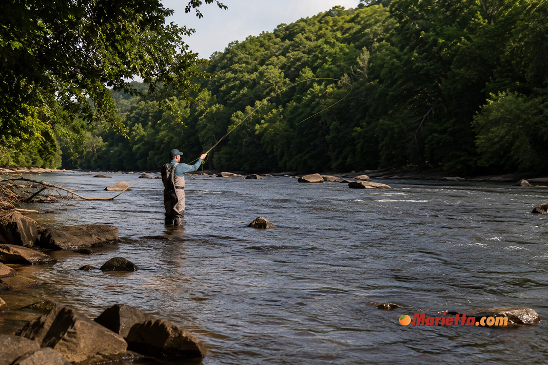
Southernmost River for Trout Fishing
The Chattahoochee River is one of the southernmost rivers in the United States where you can fish for trout. This is possible due to Buford Dam releasing cold water from the bottom of Lake Lanier. Each year, the Department of Natural Resources stocks the area between Buford Dam and Azalia Drive with 150,000 9″ catchable trout. In addition, brown trout are naturally reproducing in the river.

Fly fishing enthusiasts can challenge themselves to catch these big brown trout, while bank fishing fans can often attract rainbow trout. The river is also home to bass, catfish, and 20 other species of fish. Year-round fishing is available, and for those 16 or older, a Georgia fishing license with a trout stamp is required.
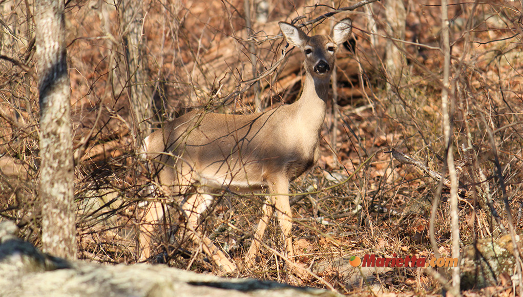
Visitors can enjoy hiking trails that wind through wooded areas, along the river, and up to scenic overlooks. Wildlife viewing opportunities are plentiful, with sightings of white tailed deer, fox, beaver, rabbits, raccoons, turtles, bald eagles, and nearly 200 other bird species.
The park also has historical significance, as it was once home to several Native American tribes and served as a key transportation route during the Civil War. The park remains an important natural resource for the region, providing numerous recreational and ecological benefits.

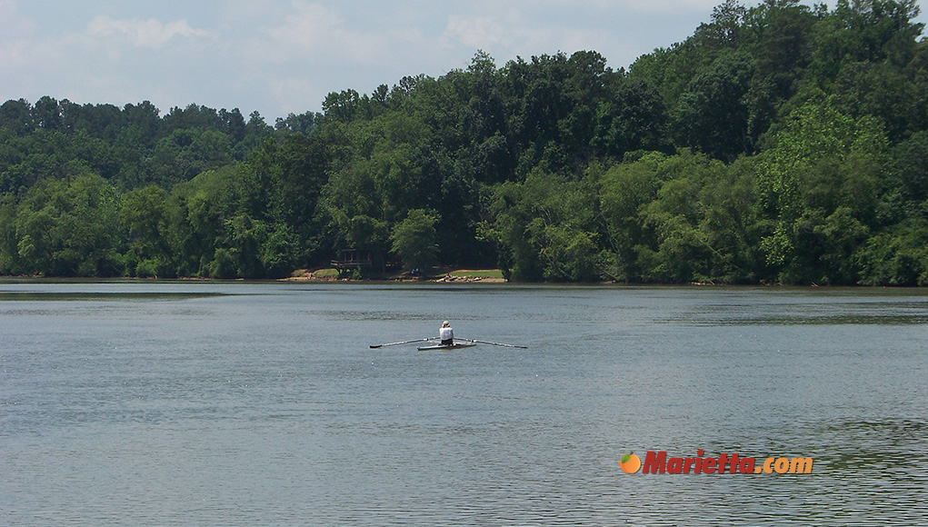
On the Water
The Chattahoochee River provides an excellent waterway experience for canoeing, kayaking, and rafting, with a Class I and II rating. However, certain sections of the river may be classified as Class III due to narrow passages, high water levels with erratic waves, and cold water.
The presence of submerged rocks and jagged tree snags can create strong currents, making rubber-soled shoes essential for tackling broken glass and slippery rocks. Before setting out, it is important to check the river conditions as water release from upstream dams can cause a rapid rise in water level.
If you have your own watercraft, the Chattahoochee River is accessible year-round. Alternatively, outside the park, commercial businesses offer raft and canoe rentals from May through Labor Day.
Vickery Creek
The Vickery Creek Unit is a popular destination for outdoor recreation, including hiking, biking, and fishing. It is named after Vickery Creek, which runs through the area and is a tributary of the Chattahoochee River. It is also home to the historic Roswell Mill complex, which was built in the mid-1800s and played an important role in the industrial development of the area.
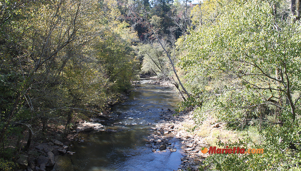
Part of the Roswell Mill complex, the Ivy Mill ruins still stands near the mouth of Big Creek in the Vickery Creek Unit. The mill produced cotton and wool, including a blend known as “Roswell Gray”, which was used to make Confederate uniforms during the Civil War. Visitors to the Vickery Creek Unit can explore a variety of trails that wind through the forested hills along the creek.
Vickery Creek Trails Parking:
400 Riverside Rd, Roswell, GA 30075
The trails can also be accessed from Roswell Mill – see below:
95 Mill St, Roswell, GA 30075
Roswell Mill
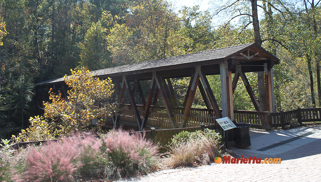
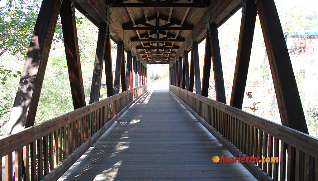
The Roswell Mill is a popular historic site at the Vickery Creek Unit, with the ruins of historical structures including the mill complex, the mill waterfall, and the Vickery Creek Old Mill Machine Shop. Roswell Mill is also home to the scenic Roswell Mill Covered Bridge, connecting Roswell’s Old Mill Park to the six miles of hiking trails in Vickery Creek.
The Roswell Mill was originally built as a cotton mill, with the power to operate the mill coming from the nearby Vickery Creek. The mill was built in the mid-1800s and played a significant role in the industrial development of the area. Over the years, the mill complex expanded to include a number of other buildings and structures, including a machine shop, a warehouse, and a company store.
During the American Civil War, the Roswell Mill was seized by Union troops and used as a supply base. After the war, the mill was rebuilt and a second mill was built in 1882. The Roswell Manufacturing Company switched to steam power in 1897 and continued to operate until the 1975.
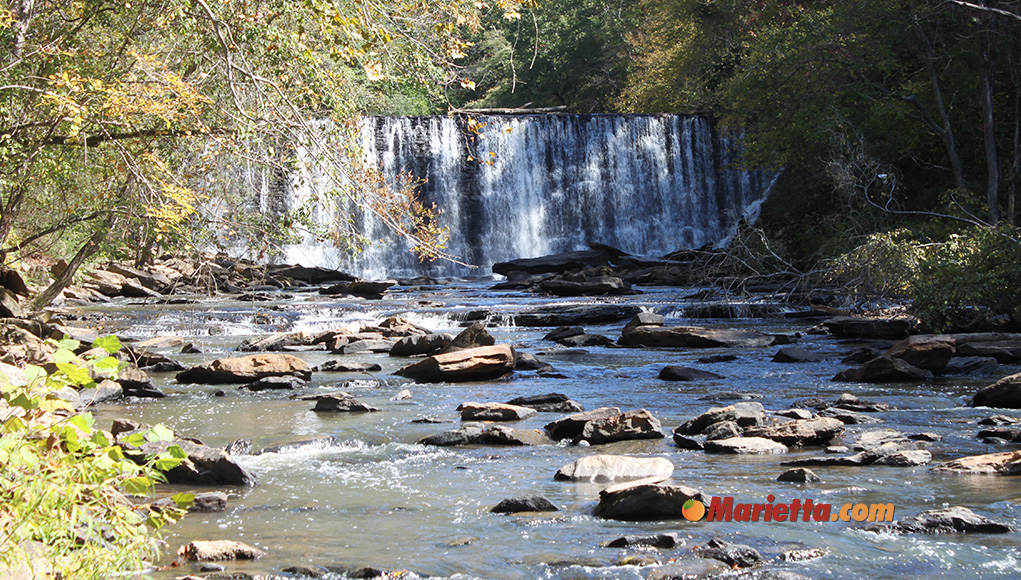
Today, visitors can explore the ruins of the mill and other historic structures including the Roswell Mill waterfall. The nearby Roswell Mill Covered Bridge, which dates back to the 1800s and spans Vickery Creek, is also a popular spot for photography and picnicking, and provides visitors with a fascinating glimpse into the region’s industrial past.
Roswell Mill is also just minutes away from historic Downtown Roswell.
Roswell Mill:
95 Mill St, Roswell, GA 30075
Johnson Ferry
The Johnson Ferry Unit is divided into a larger northern section off Johnson Ferry Road and a smaller southern section off of Columns Drive, each with picnic areas and hiking trails. In addition to these amenities, the northern section offers a boat ramp for canoe, boat and raft launch, restrooms, and a raft rental facility.
Johnson Ferry North:
Features parking area, better hiking trails than Johnson Ferry South, canoe, boat and raft launch, and restrooms.
301 Johnson Ferry Rd SE, Marietta, GA 30068
Johnson Ferry South – Columns Drive:
Features one of only three pavilions in Chattahoochee River National Recreation Area, picnic tables and grills, a small field, and a very short mostly viewless hike. There is no restroom facility, potable, or electrical service at this location.
4630 Columns Dr SE, Marietta, GA 30067
Cochran Shoals
Cochran Shoals is the largest and most popular spot along the recreation area. The shoals features the historic Marietta Paper Mill ruins along Sope Creek and a 3 mile loop fitness trail open to joggers, walkers, and bikers. In addition to the main trail, Cochran Shoals also offers several secondary trails that provide additional opportunities for exploration and recreation.
Cochran Shoals has a rich history, dating back to the early 1800s when the area was settled by European immigrants. The park was once home to several mills, including the paper mill that produced the paper for the Atlanta Constitution newspaper. The park also played a role in the Civil War, with Union and Confederate troops crossing the Chattahoochee River at Cochran Shoals during the Atlanta Campaign.
Cochran Shoals is approximately 1,000 acres in size and is easily accessible from Interstate 285 and Interstate 75. The Cochran Shoals Trail is a fully accessible path.
Cochran Shoals – Columns Drive
Features a parking area and hiking trail.
152 Columns Dr, Marietta, GA 30067
Cochran Shoals – Sope Creek:
Features a parking area, picnic area, hiking trail, and bicycle trail.
3726 Paper Mill Rd SE, Marietta, GA 30067
Cochran Shoals – Interstate North
Features a parking area, hiking trail and a picnic area.
1956 Eugene Gunby Rd, Marietta, GA 30067
Cochran Shoals – Powers Island
Features a parking area, hiking trail, and canoe and raft launch on the east side of the Chattahoochee River.
5450 Interstate N Pkwy, Sandy Springs, GA 30328
Akers Mill Access Point
Akers Mill trail and Palisades West trails are located off the Interstate North Parkway near the Paces Mill and Rottenwood Creek areas. The trails are considered a moderate hike with some steep sections, but overall it is a relatively easy hike with well-maintained trails.
The trails offer stunning views of the Chattahoochee River and its surrounding forested hills. Along the trail, hikers will also encounter rocky bluffs, small waterfalls, and perhaps wildlife such as deer, turtles, and a variety of bird species. The trail is also pet-friendly, but dogs must be kept on a leash at all times.
Palisades West Trail:
Features a parking area, hiking trail, and restrooms.
932 Akers Ridge Dr SE, Atlanta, GA 30339
East Palisades Trail:
Features a parking area and picnic area off the roads of Harris Trail and Whitewater Creek Road. About 3 miles into the East Palisades Unit trail at marker EP 26, you can find the giant bamboo forest, one of the 7 natural wonders of metro Atlanta.
4058 Whitewater Creek Rd NW, Atlanta, GA 30327
East Palisades Unit – Indian Trail:
Features a parking area and hiking trail, this trail leads to an overlook above Devils Race Course Shoals.
1425 Indian Trail NW, Sandy Springs, GA 30327
Paces Mill
The Paces Mill Unit is located off Interstate North Parkway, just west of Interstate 75 in the Cumberland area of Cobb County. The park is approximately 180 acres in size and offers a wide variety of recreational activities for visitors, including hiking, fishing, boating, picnicking, and wildlife watching.
The Paces Mill Unit has several hiking trails, including the scenic Rottenwood Creek Trail, which follows the Chattahoochee River and features rocky bluffs, small waterfalls, and a variety of wildlife. The trail also connects with the nearby Palisades West Trail to the north.
Paces Mill Unit:
Features hiking and bike trails, picnic areas, and a restroom.
3444 Cobb Pkwy, Atlanta, GA 30339
Island Ford Unit and Visitor Center
The Island Ford Unit is one of the most iconic river experiences and home to the main visitor center for the Chattahoochee River National Recreation Area. The Island Ford Unit offers a variety of recreational opportunities for visitors, including hiking trails, fishing, picnicking, canoe and raft launch, wheelchair-accessible trail, and restrooms. There are several trails with scenic views of the Chattahoochee River, ranging from easy strolls to more strenuous hikes. Other features found at the Island Ford Unit include Island Ford Shoals and Don White Memorial Park, operated by the City of Roswell.
The Island Ford Visitor Center provides information and educational resources about the park’s natural and cultural resources. At the center, visitors can purchase daily or annual park passes, get maps, obtain the latest park conditions information, and shop at the Eastern National store. In addition, the center offers exhibits, audiovisual presentations, and ranger-led programs to help visitors learn more about the history and ecology of the area.
Hours:
- The visitor center building is open daily from 9 am to 5 pm every day except for Thanksgiving and Christmas
- The parks and parking lots are open daily from sunrise to sunset
Admission:
Park 1 Day Pass – $5
Park Annual Pass – $40
America The Beautiful Annual Pass – $80 (all U.S. National Parks)
(prices current as of 4/23)
Daily and annual passes are available, and only one pass is needed per vehicle. Physical hard plastic cards for daily passes and annual passes are available for sale at the Island Ford Visitor Center, and digital copies of the passes are available online at recreation.gov. If you plan to purchase your pass upon arriving at a parking lot, you can scan the QR code posted at the parking lot. If you purchase a day pass in advance and a parking lot is full, you will need to visit a different unit as a pass does not guarantee a parking space. Hard plastic cards must be placed on your vehicle’s dashboard or rearview mirror. Digital passes have no visible pass to display so compliance is checked via your vehicle’s license plate. If you already have a valid America The Beautiful national park pass, admission is free.
Island Ford Visitor Center Address:
1978 Island Ford Pkwy, Atlanta, GA 30350

For more information about the Chattahoochee River National Recreation Area, please call the National Park Service at 678-538-1200 or visit nps.gov/chat
Staying Safe While on the River
- Make sure you know where you’re putting in and taking out, and tell someone else your plans.
- Cellular phone service is available in most parts of the park, but coverage gaps may exist in spots along the river or in steep ravines.
- Before entering the water downstream of dams, check for water-release schedules.
- Keep an eye on the weather and water conditions. If bad weather is on the horizon, head for shore. If there’s lightning, get out of the water and seek shelter away from trees. In summer, lightweight, quick-drying clothing is fine, but during cooler seasons, wear clothes made of natural and synthetic fibers. If it’s cold out, wool clothing is best as it retains heat even when wet. And always wear appropriate footgear.
- Drinking alcohol impairs coordination and judgment, so it’s best to avoid it while on the river.
- Avoid diving or jumping into the river, as there are submerged rocks, murky water, and fluctuating water levels that can be dangerous. Swimming is not recommended.
- Glass containers are not allowed on the river today, but there is still leftover glass from years past, so wear appropriate footwear.
Hypothermia Risk:
- The water in the river is typically quite cold. If your watercraft flips and you capsize, be sure to get out of the water as fast as possible and warm yourself.
Personal flotation Device:
- A personal flotation device is required to be worn if you are boating, tube floating, or wading in the river between Buford Dam and the GA 20 bridge and between Morgan Falls Dam and the Morgan Falls boat ramp.
- You must have a wearable, appropriately sized, U.S. Coast Guard approved personal flotation device for each person on board your watercraft (i.e. canoes, kayaks, rafts, boats, float tubes, inner tubes, air mattresses).
- All children under the age of 13 must wear a U.S. Coast Guard approved personal flotation device when the watercraft is underway.
Approximate Float Times and Distances
|
From |
To |
Distance |
Float Time |
|
|---|---|---|---|---|
|
Canoe |
Raft |
|||
|
Buford Dam |
Abbotts Bridge |
13 miles |
6 to 8 hours |
9 to 10 hours |
|
Abbotts Bridge |
Medlock Bridge |
4 miles |
1 to 2 hours |
3 to 4 hours |
|
Medlock Bridge |
Jones Bridge |
3 miles |
1 to 1½ hours |
1½ to 2 hours |
|
Jones Bridge |
Chattahoochee River Park * |
12 miles |
6 to 8 hours |
9 to 12 hours |
|
Morgan Falls Dam |
Johnson Ferry |
2 miles |
½ to 1 hours |
1 to 2 hours |
|
Johnson Ferry |
Powers Island |
3½ miles |
1 to 3 hours |
2 to 4 hours |
|
Powers Island |
Paces Mill ** |
3 miles |
1 to 2 hours |
1 to 3 hours |
| * Chattahoochee River Park is the last take out point before Morgan Falls Dam. ** Paces Mill is the last take out point in the Chattahoochee River National Recreation Area. |
||||
For more information about the Chattahoochee River National Recreation Area, please call the National Park Service at 678-538-1200 or visit nps.gov/chat

